The NIST Bucker Holder was updated to be larger due to prop wash knocking the buckets off the holder. Please download the new ZIP folder for the updated files.
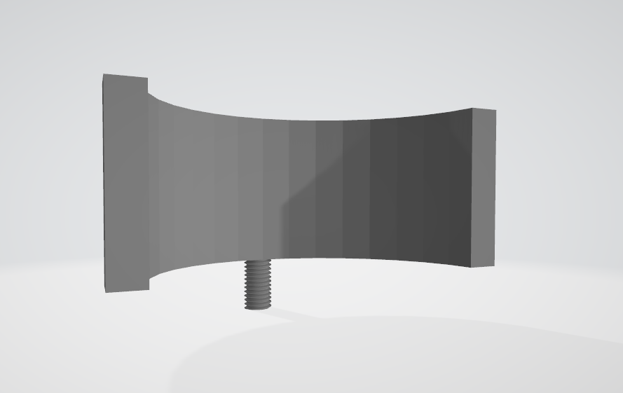
The NIST Bucker Holder was updated to be larger due to prop wash knocking the buckets off the holder. Please download the new ZIP folder for the updated files.
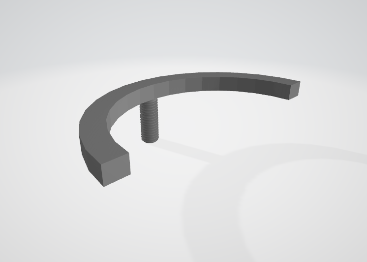
Rather than using a screw and nut inside the bucket, you can attach the bucket holder and keep them attached. The buckets can then be dropped in and easily removed.
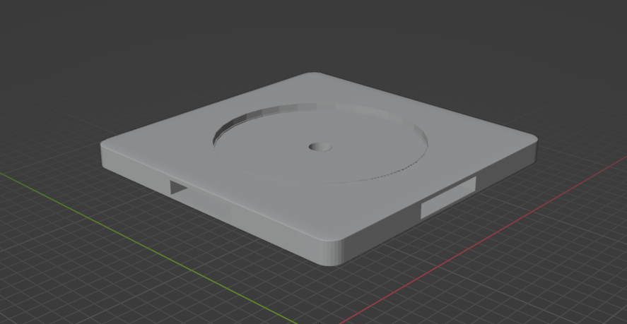
Now the anchors can fit nicely into this pad. The top bucket can be freely placed without bolts/nuts. No need for a stabilizing bolt. Refer to the download page on the 3D Printed NIST Course page for the new download. This STL is located in dist->Anchor->new-connector.stl.
-We have fixed some bugs in the NIST simulator which would cause users to always fail the mission, regardless of their score.
-Improved lighting
We’ve resolved a critical issue that was preventing users from completing the NIST Position Course! 🎯
Some users encountered a bug that blocked them from progressing through the course, causing frustration and delays. After thorough testing and debugging, we’ve identified and fixed the issue, ensuring a smoother experience moving forward.
✅ What’s Fixed?
If you were affected, you can now resume your training without any issues. As always, we appreciate your feedback—your reports help us make the platform better every day! 🙌
If you run into any other issues, feel free to reach out. Happy training! 🛸🎓
We’re thrilled to announce two major enhancements to the Mission Ready UAS simulator platform:
1️⃣ Simulator Time Tracking
Now you can monitor and log your training hours directly within the simulator! This new feature helps pilots and instructors track progress, document practice time, and ensure everyone meets their training goals. Perfect for professional development or earning certifications!
2️⃣ Car Scenario Module
Take your training to the next level with our new Car Scenario. This feature simulates a dynamic environment involving a vehicle containing weapons and other items to be identified by the drone operator. Designed to replicate real-world scenarios for first responders, it’s ideal for practicing vehicle reconnaissance, crime scene investigations, or traffic stop safety assessments. Hone your skills in identifying critical threats or evidence while managing a complex operational environment.
Both updates are designed to enhance training realism and provide public safety professionals with the tools they need to succeed in the field.


We’ve introduced a new building specifically designed to simulate interior operations, providing a more realistic and immersive training environment. Additionally, a loading screen has been implemented to enhance user experience and streamline navigation. This is just the beginning—future updates will build upon the interior operations simulation, expanding its functionality and offering even more advanced features to elevate the training experience.
Three modes were added to the simulator:
Drone now “drifts” in all modes to add to realism.
Several bug fixes were made.
Introducing the SGI Tool – Simplify Mapping and Coordinate Conversion for FAA Requests
We’re excited to announce the release of the SGI Tool, now available on MissionReadyUAS.com! This powerful, user-friendly tool is designed to help public safety professionals, drone pilots, and emergency response teams streamline the process of mapping locations and converting coordinates into Degrees, Minutes, and Seconds (DMS) format—perfect for completing the FAA Emergency Operation Request Form quickly and accurately.
The SGI Tool was developed to simplify critical mission planning tasks, enabling first responders and drone operators to focus on the mission—not paperwork. Whether you’re preparing for a search and rescue mission, disaster response, or tactical operation, the SGI Tool will make the process faster, easier, and more reliable.
The SGI Tool is now live and ready to support your missions. Visit MissionReadyUAS.com and check out the SGI Tool page to see how it can streamline your workflow and help you stay mission ready!
Your mission starts here—faster, easier, and more accurate with the SGI Tool.